LOAD FROM
Used to load data from a file, database, or GIS (ArcMap, Google Maps) into the Data Table.
When loading data, DNRGPS looks for information vital to loading into the GPS. Information such as Lat, Long, Ident, and Comment. Note: If an “IDENT” field is not found, you will be prompted to select which field to use.
The default projection in DNRGPS will automatically be changed to match the projection of the loaded data:
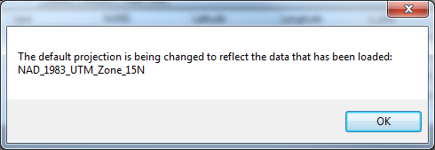
Note: You may see this message even if you have the proper projection already set. See TROUBLESHOOT for more details.
Database
Load from an existing database connection by selecting a database under Database Name, and all the available layers appear in the Layers list box.
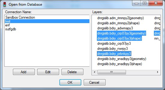
Edit or delete an existing connection, or add a new connection using the buttons below the Database Names.
PostgreSQL for PostGIS - Set up a connection to a PostgreSQL database and select layers to load. Connection name is the name that displays in the list of available databases.
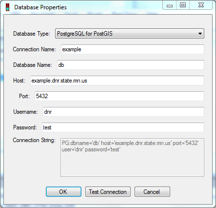
Note: There are 2 types of shapes that can be saved in a Postgres Database: Esri and Open Source. DNRGPS saves and reads the open source shapes.
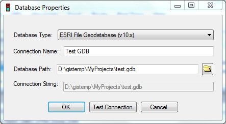
ESRI File Geodatabase (v10.x) - Navigate to an ESRI File Geodatabase and select feature classes to load. Note: The open source File Geodatabase reader/writer that DNRGPS uses does not work with feature datasets.
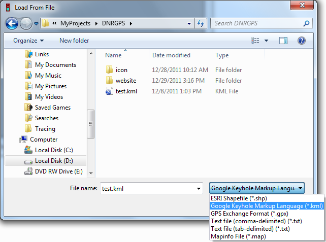
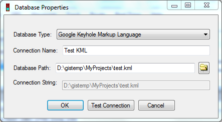
Google Keyhole Markup Language - For a KML file with more than one layer, navigate to it and select which layers you want to load. A layer is reflected as a folder in Google Earth.
ArcMap
Only works if ArcMap is open.
Layer - Load data from a layer in the active data frame. If a layer is selected it will load from it, otherwise you’ll be prompted to select the proper layer. Will grab the selection set or all if no records selected.
Selected Graphics - Load data from ArcMap Graphics in the active data frame. Selected graphics do not all need to be of the same shape type. Points will be loaded as waypoints; lines and polygons are loaded as tracks.
Google Earth
Only works if Google Earth is installed (doesn’t need to be open).
My Places - Loads data from Google Earth’s “My Places”. User is prompted to identify the layers to load from my places. Layere are represented as folders in Google Earth.
See Also