ADD HOTLINK IMAGES
Many people use their GPS in conjunction with a digital camera. A conservation officer may mark a waypoint where an environmental offense occurred and also take a picture of it. A parks worker may have a waypoint for each campsite in a state park as well as a photo of each campsite. The DNR GPS program allows you to match up the GPS data with digital images so that the Hotlinking capabilities of ArcMap may be used.
Match Images to GPS Data Directions:
Download Waypoints or Tracks from the GPS or load a waypoint/track file.
Note: If the original image date and time is not recorded you will not be able to create the hotlinks based on a date/time match.
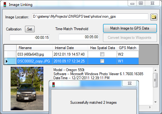
Go to Edit => Add Image Hotlinks. In the Image Linking form that opens, for the Images Location, navigate to the folder where the images are stored.

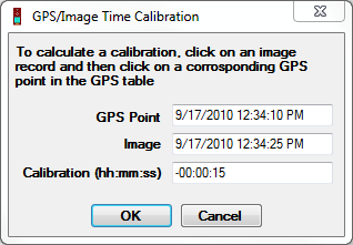
Specify a Time Calibration (Optional). If you know the clock time difference between the GPS and Camera you may enter that into the Calibration section. Alternatively, if for one of the images, you know which waypoint it matches, click the Set button to open up the GPS/Image Time Calibration dialog box. Click on the image in the Image Linking dialog box and the corresponding waypoint in the data table to compare the timestamps of the image and point. The Calibration value will automatically populate; then click OK. Most of the time, your GPS clock and your Digital Camera clock will not match exactly. By setting a calibration value you identify the time offset between the two.

Specify a Time-Match Threshold in hh:mm:ss. This threshold identifies the maximum time differential that may exist between a waypoint and a matching image. For example, if the threshold is set to 5 minutes, a waypoint will not match to any image that has a date/time greater than 5 minutes from its own date/time.
Click Match Image to GPS Data. Each waypoint date will be compared to each image date and the image with the best match will be added to the FILENAME field in the waypoint table.

Save the Waypoint table to a shapefile in ArcMap. Make the new layer active and use the hotlink tool to analyze the results. Note: You may save as a shapefile outside of ArcMap as well and then later open it in ArcMap to use its hotlinking capabilities.
Convert Images to Waypoints Directions:
If your photos already have spatial information tagged, you can use this option to create waypoints that can link to these photos in ArcMap.
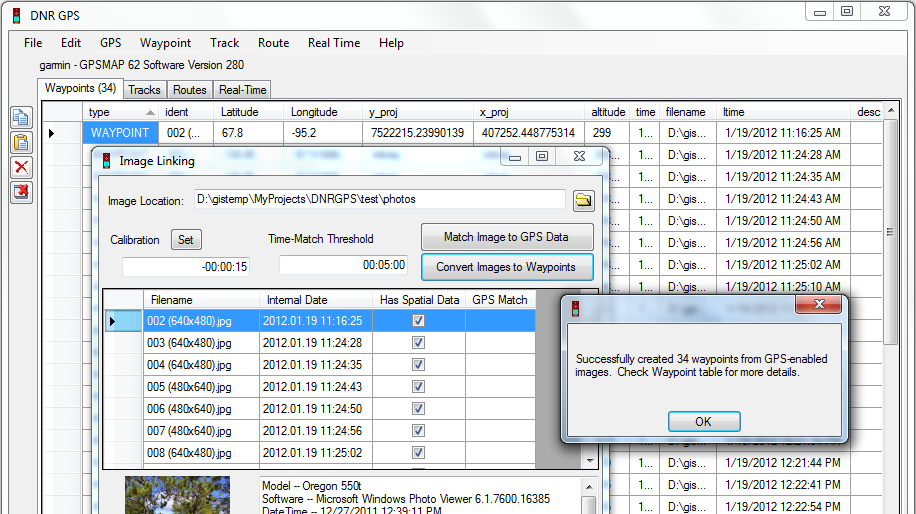
- Go to Edit => Add Image Hotlinks. In the new Image Linking form that opens, for the Images Location, navigate to the folder where the images are stored.
- Click Convert Images to Waypoints. For each georeferenced image in the specified folder, a new waypoint will be created. All fields available in the tags of the jpg file will be populated for the waypoints, including Lat/Long, y_proj/x_proj, filename, time, ltime, altitude, etc.
